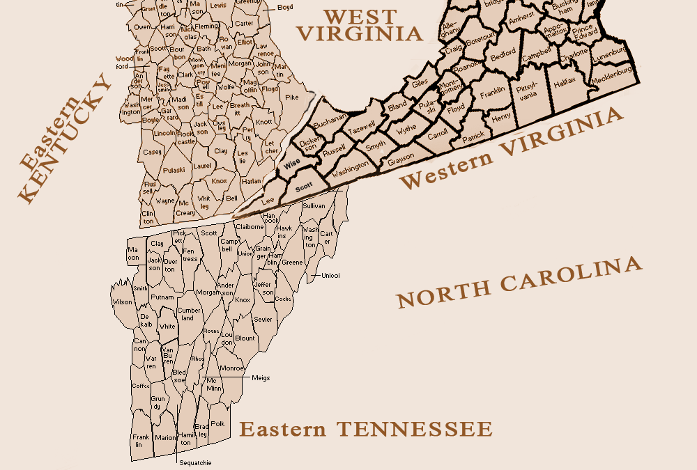
One of the things that really annonys me (ask my husband, I’ve got a long list of annoyances) is that when I look for a map to find a county in Tennessee I can’t tell where it’s possitioned in comparison to counties in Virginia. When tracing the migration of the Pryors I really want to see where people started off and where they were going. So I’ve created a cut and past map that roughly shows the position of states, where their borders were and which counties touched eachother or were near eachother.
In tracing another branch of my family who lived in Hawkins County and Hancock County, TN I found that just across the border in Lee and Scott Counties in VA there were many people who were born in TN. Even the census records (or maybe just the census taker) were unique in that they listed not only the state, but the county in which people were born. With the map I get a clearer perspective of just how close these counties were to eachother and that ofcourse even in the early 1800’s people traveled from county to county.
If you’d like to see the map larger, click on the image. In Internet Explorer you can click again to make it even larger.

